Searching for a complete List of Top Hill Stations in Pakistan then here you find all as Pakistan is amongst one of those fortunate countries in the world which immensely blessed by the blessings of nature as they are heavily equipped with natural attractions and scenic beauty which has attracted and pleased millions of people not only within Pakistan but at the same time millions of tourists visits these places annually which plays a vital contribution in the GDP of the state. There are so many hill stations in Pakistan that have their own worth and significance; amongst these still station few renowned and highly appreciated hill stations in Pakistan include the following list:
List of Top Hill Stations in Pakistan
1. Kaghan Valley
61 Kilometers long landscape of the Kaghan Valley with its towering Himalayan peaks, peaceful lakes, majestic glaciers, and splashing waterfalls is a scenic wonderland, ending northwards in the 4148 meters (13,600 ft) high Babusar Pass, jeep service is available in the valley during summer, while motels and rest-houses offer comfortable accommodation.
2. Hunza Valley
The Hunza Valley is a mountainous valley in Gilgit in the Gilgit-Baltistan, Pakistan autonomous region. The Hunza Valley is situated to the north of the Hunza River, at an elevation of around 2,500 meters (8,200 ft). The territory of Hunza is about 7,900 square kilometers (3,100 sq mi). Karimabad (formerly called Baltit) is the main town, which is also a very popular tourist destination.
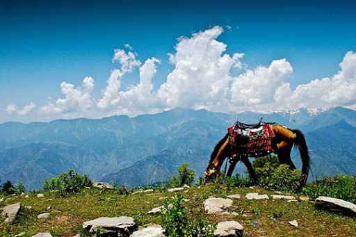
3. Gilgit Baltistan
Gilgit Baltistan is one of the most spectacular regions of Pakistan. Here are the world’s three mightiest mountains ranges – the Karakorum’s, the Hindukush, and the Himalayas-meets. The entire Gilgit-Baltistan is like a paradise for mountaineers, climbers, trekkers, hikers, and anglers. The region has a rich cultural heritage and a variety of rare flora and fauna.
Historically, the area has remained a flash point of political and military rivalries between the Russian, British, and Chinese empires. Immediately after the end of British rule in the sub-continent in 1947, the people of this region decided to join Pakistan through a popular local revolt against the government of Maharaja of Kashmir.
4. Chitral
The capital of the Chitral district is Chitral town, situated on the western bank of the Chitral River (or Kunar River). The population is about 20,000. Chitral is situated near the Karakorum, the Hindu Kush, and the mighty Himalayas. The city stands at the foot of the Tirich Mir, the highest peak of the Hindu Kush, about 25,000 feet high. In the middle of the town where the river makes a big turn, there is the former ruler’s palace surrounded by the woods. Aside from the fort and at the edge of the sports ground is the Shahi mosque. The main street runs straight from north to south and along it is the bazaar with its various shops. At the end of the bazaar is the polo ground.
5. Abbottabad
Abbottabad, the headquarters of Hazara Division, situated at an altitude of 1,225 m (4002 ft) above sea level and surrounded by the refreshing green hills of Sarban, is one of the best-known hill resorts of Pakistan. It is situated on the Karakoram Highway (Silk Route) to China, 120 Km from Rawalpindi/Islamabad, and 205 Km from Peshawar. The climate is temperate with 4 distinct seasons-springs, summer, autumn, and winter. The summer is pleasant while the winter is moderately cold with occasional snowfall. The city is non-industrial, situated in the green or ash valley, and is free from environmental pollution. It has a population of over 300,000. Like much of the mountainous Northern Areas of Pakistan, tourism is one of the important sources of economic activity in Abbottabad, in summer when temperatures in the plains of Pakistan rise to well above 45 degrees Celsius, a large number of tourists travel north to Abbottabad to shelter from the blistering heat.